blah blah blah
Lone Oak Trail
Length: 1.6 miles out-and-backDifficulty (click for info): Easy
Elevation Gain: 770 feet (+60 feet on return)
Rating (click for info): 6/10
Elevation: 1199'
Prominence: 38'
Driving Directions:
Trailhead and parking area are on Abbott Avenue in Bath, NH. From the junction of Rt. 302 and Rt. 135 in the center of Woodsville, drive north on Rt. 135 for 0.3 miles, passing by the covered bridge. Take the first right after the bridge onto Abbott Avenue and drive 0.2 miles. Look for the trailhead on your left, across from near the end of the field. There is a rough parking space for one or two cars. Click here for a Google map.
Trail map
About the Hike:
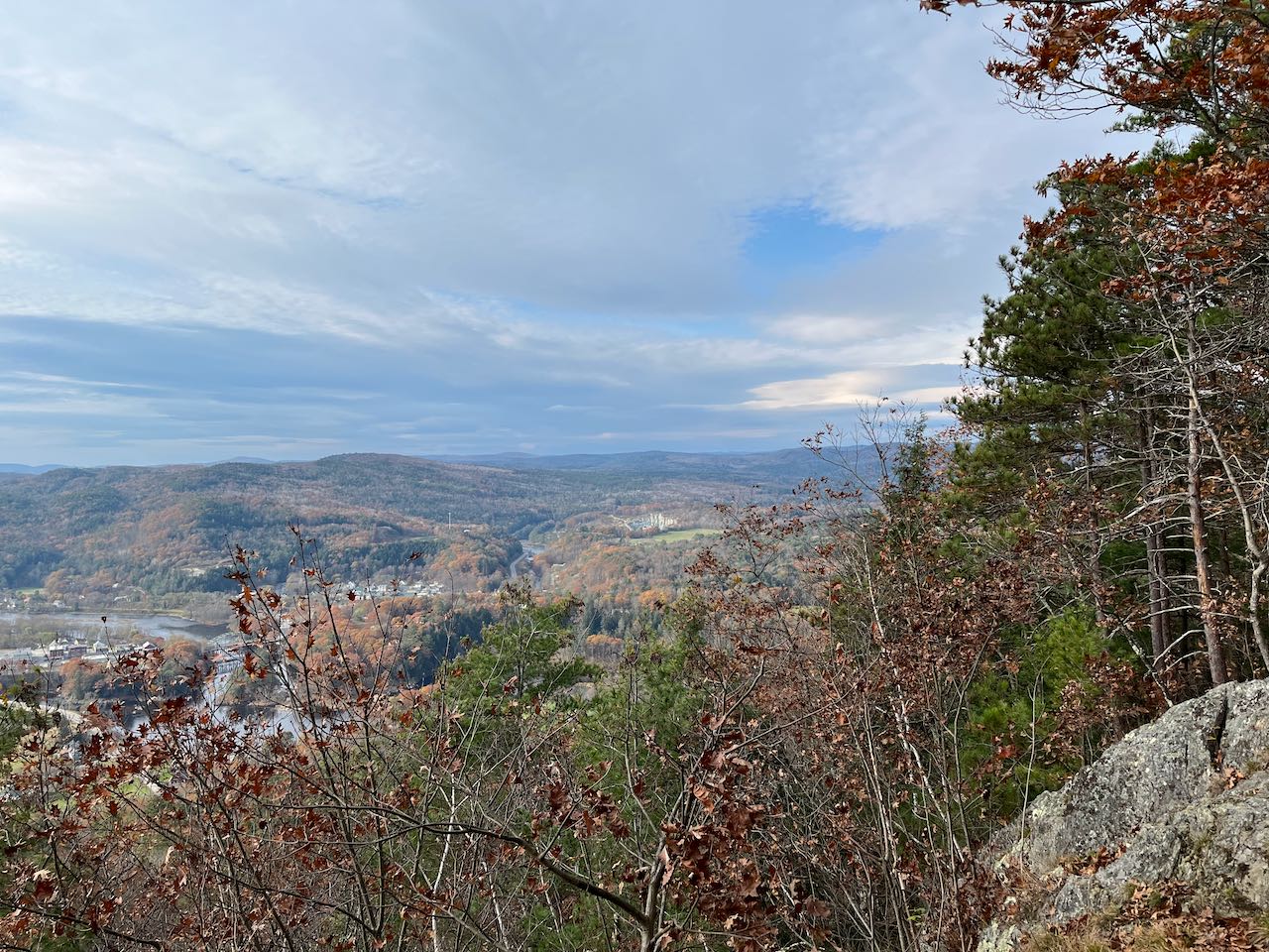
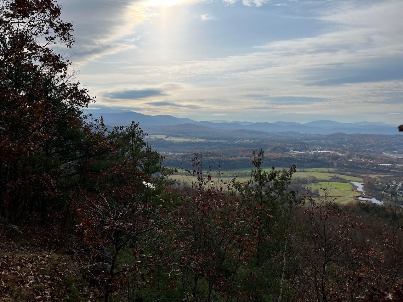
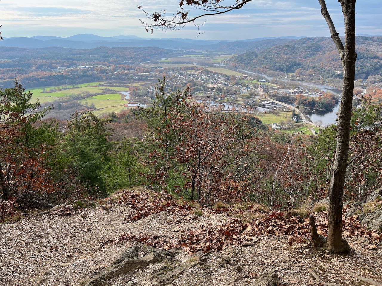
Surrounding the confluence of the Ammonoosuc and Connecticut Rivers is the small village of Woodsville in Bath, NH, and not much else. It's a quaint and peacefully isolated world of farmland and rivers. Just outside the village center, past the covered bridge, you'll find the Lone Oak Trail, a short and sweet hike that leads you up to a lovely viewpoint at the far south end of the Gardner Ridge. The route gets moderately steep in places, but take your time and the end result is a pastoral view across the Connecticut River Valley that will lure you in to relax and enjoy for hours.
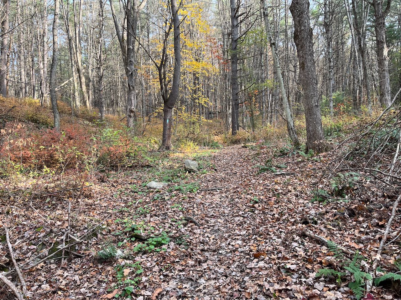
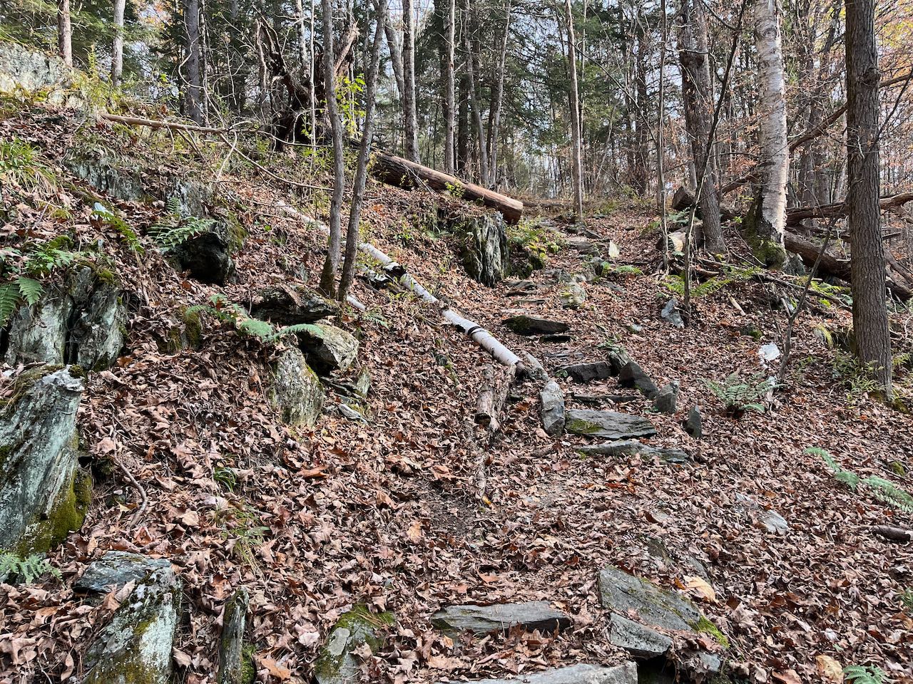
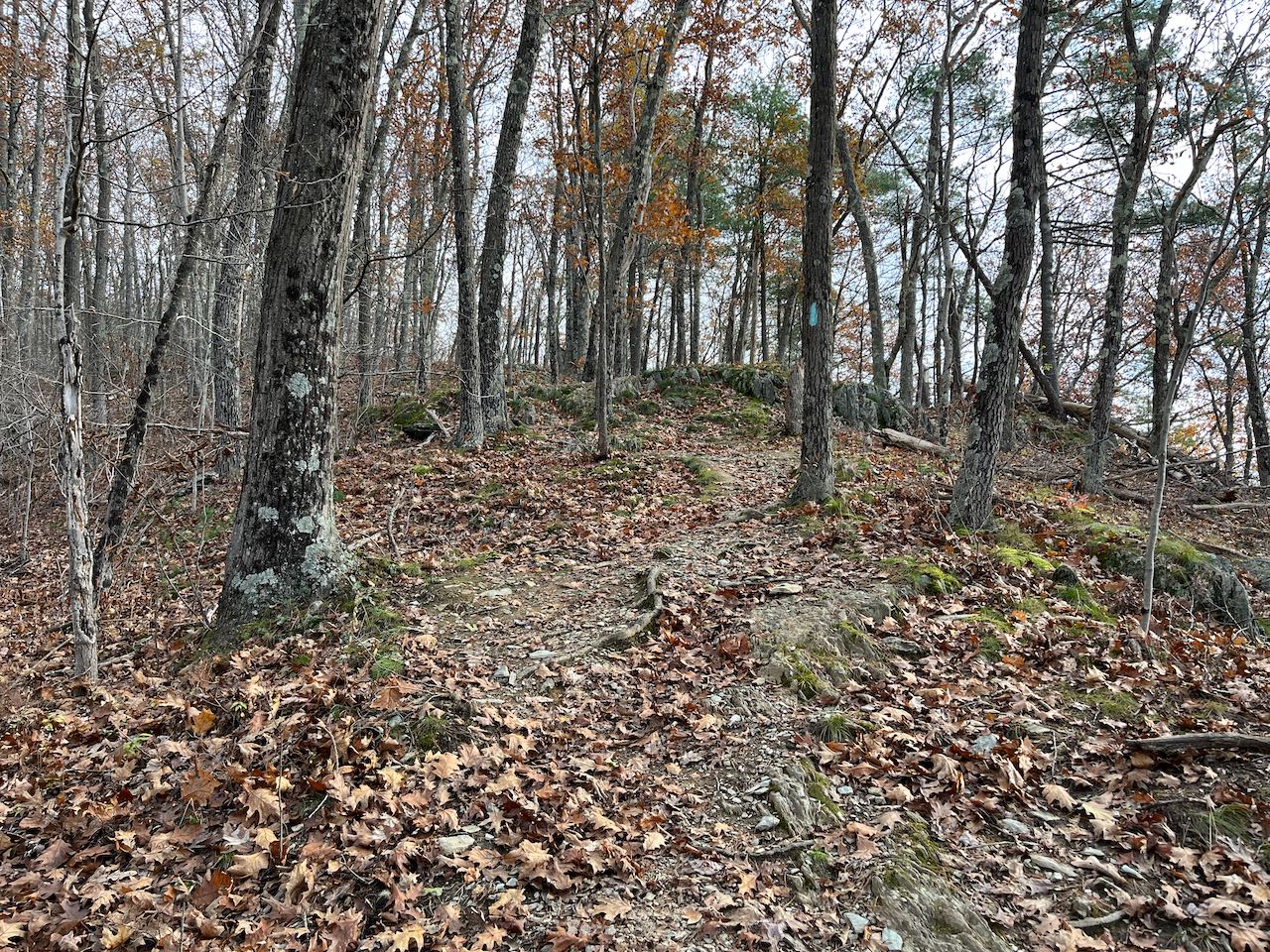
Start your hike at the welcoming green sign up the Lone Oak Trail, which climbs a steep embankment into the woods and then levels off in a little hollow. The trail cuts across the hillside and descends to pass just above a couple open fields and houses. After 0.3 miles, the trail briefly turns right onto an old woods road and then turns left back off it. It climbs up through a steep ledge band and follows a carefully-built stone walkway across the top of it. The trail then heads up the crest of a narrow and steep-sided ridge. Some sections can be steep; use caution if conditions are slippery, such as with ground leaf cover. After another 0.3 miles, the trail, rimmed with rock outcroppings, reaches a flat shoulder on the mountain and swings left. It then climbs another steep pitch, switchbacking uphill and skirting along the conservation property boundary. It reaches the top of a knoll after 0.2 miles, and proceeds down to a gravelly clearing atop a cliff. From here the view opens up back down the hill to Woodsville. The open fields and meandering rivers take center stage in the view, while rolling mountains put a backdrop on the canvas. If you look close to the trees all the way to the left, you can see the high summit of Mt. Moosilauke. In front and trailing off to the right is Mt. Clough and the Benton Range. A little further out in the distance to the right are Carr Mountain, Webster Slide Mountain, and Mt. Mist. Looking straight over the bend in the Ammonoosuc River is Piermont Mountain on the left and Mt. Cube and Smarts Mountain on the right. Wallace Hill is on the Vermont side of the Connecticut across from the village.
Printable directions page